Automated Timber Harvesting Land Base Analysis for ArcGIS Pro

Transform complex constraint analysis into actionable forest management insights. Process multiple layers, apply buffers, and generate comprehensive THLB/CFLB classifications—all from a single tool.
Understanding THLB & CFLB

THLB

Timber Harvesting Land Base

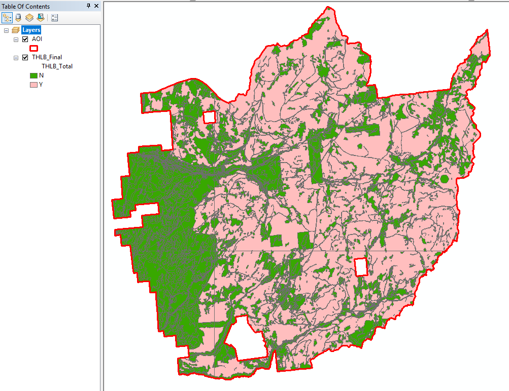
The portion of forest land where timber harvesting is both acceptable and economically feasible. Areas are excluded based on constraints like parks, wildlife habitat, steep slopes, and riparian zones.

CFLB

Crown Forest Land Base

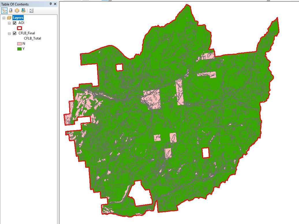
Crown-owned forested land that may have fewer restrictions than THLB. Some areas qualify as CFLB but not THLB due to additional harvesting constraints applied to the timber base.

Key Features

Excel-Driven Configuration

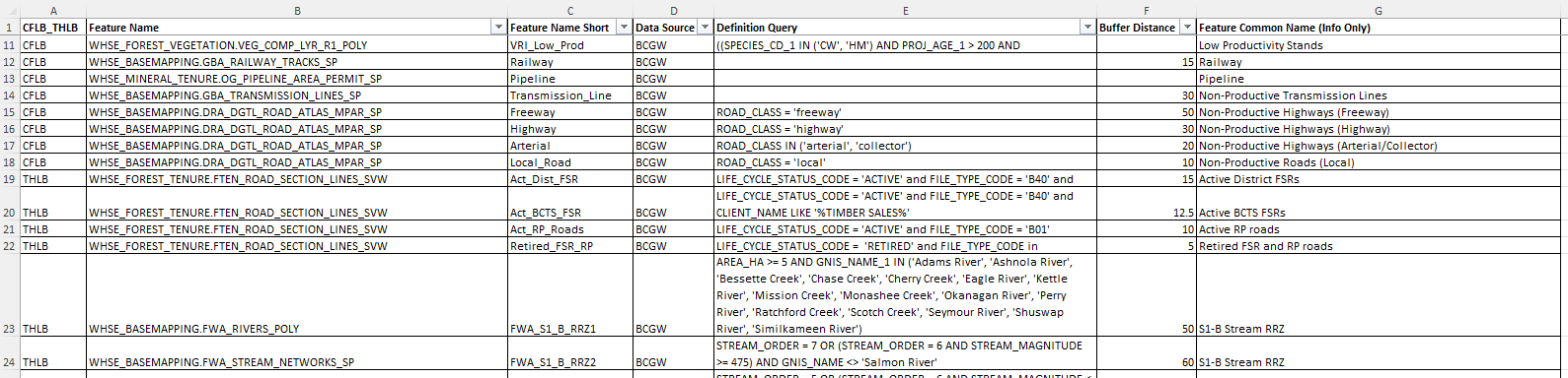
Define all constraints in a simple Excel spreadsheet. Specify feature classes, data sources, definition queries, and buffer distances—no coding required.

Multi-Layer Processing

Process unlimited constraint layers from BCGW, internal databases, or local files. Each layer is clipped, buffered, and classified automatically.

Intelligent Tiling

Large areas are automatically split using a provincial fishnet grid, enabling efficient parallel processing of extensive timber supply areas.

Comprehensive Output

Generate detailed results with Y/N classification for each constraint, plus summary THLB_Total and CFLB_Total fields for quick filtering.

Sliver Cleanup

Automatically eliminates slivers and small polygons using configurable thresholds, ensuring clean topology in your final output.

What-If Analysis

Use the Field Calculator tool to create custom summary fields that exclude specific constraints—perfect for scenario planning and sensitivity analysis.

How It Works

1

Configure Constraints

Define your constraint layers in the Excel template. Specify the feature class, data source, definition query, and optional buffer distance for each layer.

2

Define Your AOI

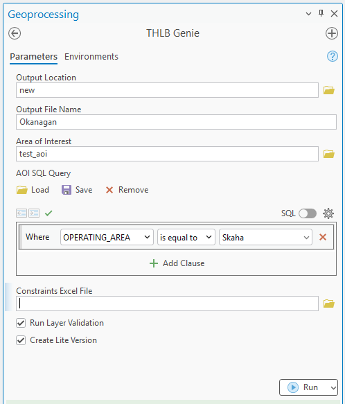
Select your Area of Interest polygon—a TSA boundary, landscape unit, or custom study area. Apply SQL filters to process specific subsets.

3

Run the Analysis

THLB Genie clips, buffers, dissolves, and unions all constraint layers. Each polygon is classified as available (Y) or excluded (N) for every constraint.

4

Review Results

Explore the detailed THLB_Final output or use the simplified Lite versions for quick harvestable/non-harvestable visualization.

Get Started

Requirements

  • ArcGIS Pro 2.9 or later
  • Python 3.x (included with ArcGIS Pro)
  • BCGW database connection
  • pandas & openpyxl packages

Included Tools

  • THLB Genie — Main constraint processing tool
  • THLB New Field Calculator — Custom summary field creator

For detailed installation instructions, parameter documentation, and example use cases, see the full README.

View Full Documentation